Project Analysis of the Divatte Valley, an alluvial plain along the Loire River
Context Graduation project
Project studio Grands sentiers, Ensa Nantes
Teachers Anne Bossé + Petra Marguc
Place District’s community Sèvre & Loire (44)
Date 2024
The Grands sentiers led by Anne Bossé, invites you to explore the area on foot, by walking. This action is as much a manifesto as it is a tool for apprehending spaces, enabling us to adopt a posture at the scale of the body in movement. With a strong focus on architectural research on Nantes, the project aims to create a major metropolitan trail by the end of its fourth and final edition in 2024. More information is available in the dedicated Hypothèse booklet https://gdsentiers.hypotheses.org/which compiles the genesis and approach of each project developed, including the Parlement de Tougas created in the same studio.
Located to the east of the Nantes metropolitan area, the Divatte Valley stretches for 14 km between the minor bed of the Loire, which corresponds to the area of the river under permanent water, and the Coteau de la Roche, a rocky outcrop carved out by the waters. The Divatte Valley is part of the major bed of the Loire, the area of influence of the river waters. It takes its name from the River Divatte, a tributary of the Loire that flows through it. This 25 km² sedimentary valley is criss-crossed by numerous boires, which collect run-off water and carry it to the foot of the hillside.
Understanding the Divatte valley means trying to work at several scales by linking spaces and entities. Over the course of a short one-month analysis period, I surveyed the valley, from the Loire to the hillside, conducted interviews and reported on my progress. Mapping was the main working tool here, enabling me to organise my research, archive my progress and pass on information throughout the process.
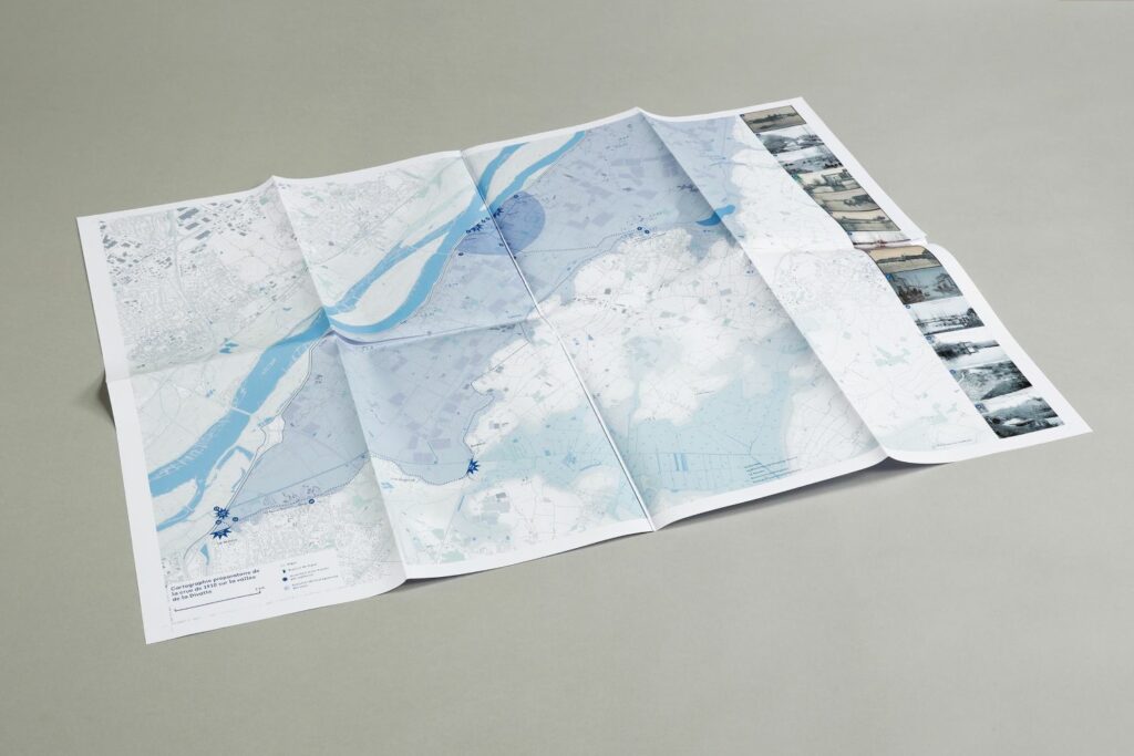
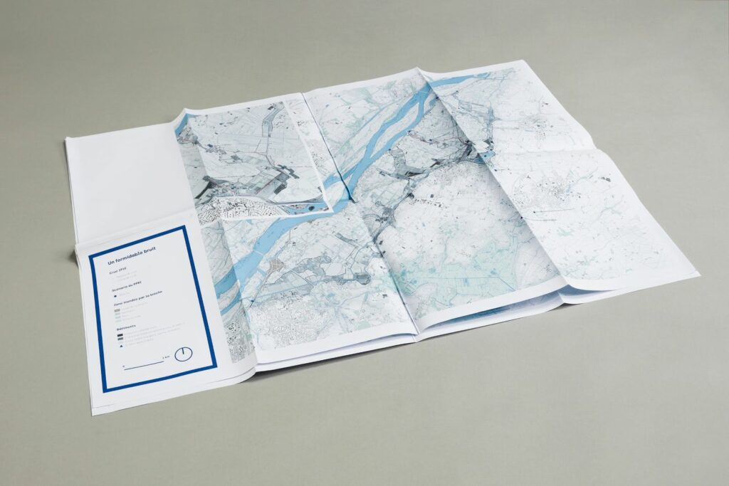
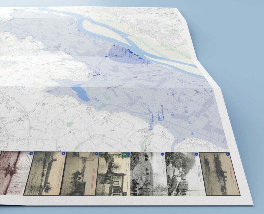
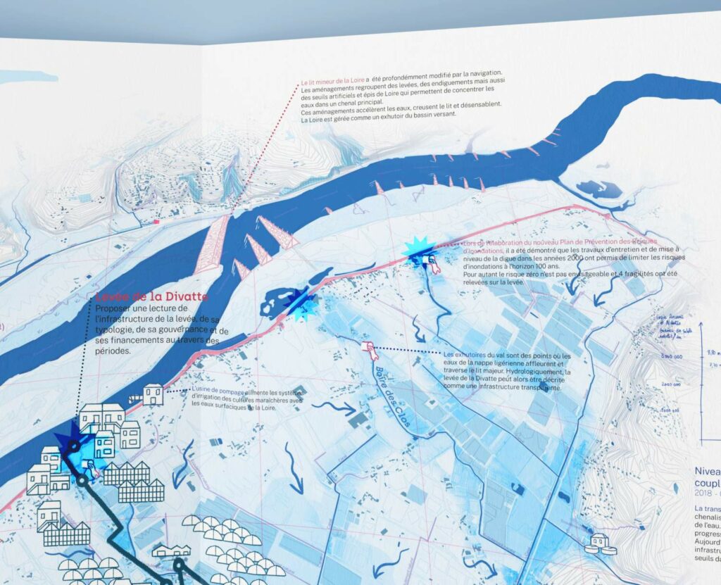
The first cartographic phase focused on historiographical research into the 1910 flood and its consequences for the area. Based on photographic, journalistic and parish archives, I was able to propose a reading of this event in time and space. This theoretical reading was then put to the test in the field during a 4-hour survey of the valley. As the starting point for the project to reopen the Coudrouse stream, this work enabled me to identify the main focus of the project, the Levée de la Divatte. The second map, titled Un formidable bruit Un formidable bruit is a synthesis of this research and the survey, and marks the start of a change of scale by looking at the Coudrouse transect.
The second mapping sequence focuses on the Coudrouse transect, from the Levée de la Divatte to the base of the Saint-Julien-de-Concelles hillside. It maps the course of waters from the 1910 flood after breaches at La Coudrouse and seeks to expose local vulnerabilities to the return of these floodwaters.
In the third cartographic sequence, spatial interpretation of the valley's interdependencies is presented. Hydraulic, urban, agricultural, industrial and governance systems in the valley are identified, mapped and linked. I quickly realised the scope of the proposal and decided to divide this work into two separate maps.
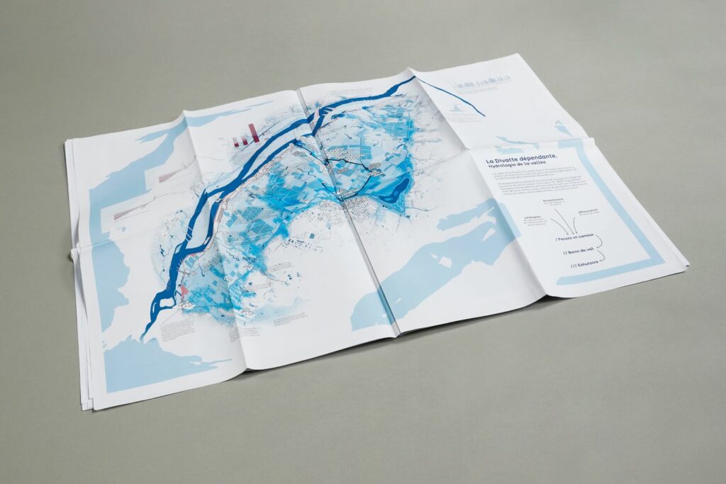
The first map focuses on the hydrology of the valley and its drainage system, initiated by the Levée de la Divatte. Located in the major bed of the Loire Estuary, the Divatte bio-region can be extended over the whole of the Loire catchment area, as well as part of the Atlantic coast. The map reflects these influences, while avoiding an overly orthographic representation that would prevent the interplay of these different scales.
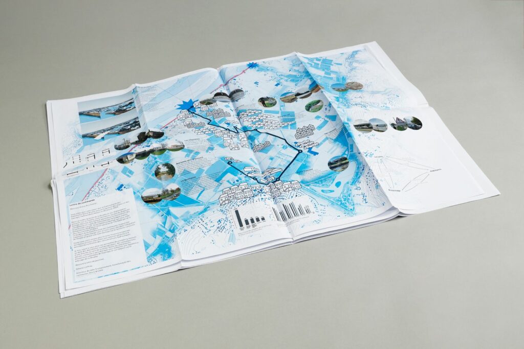
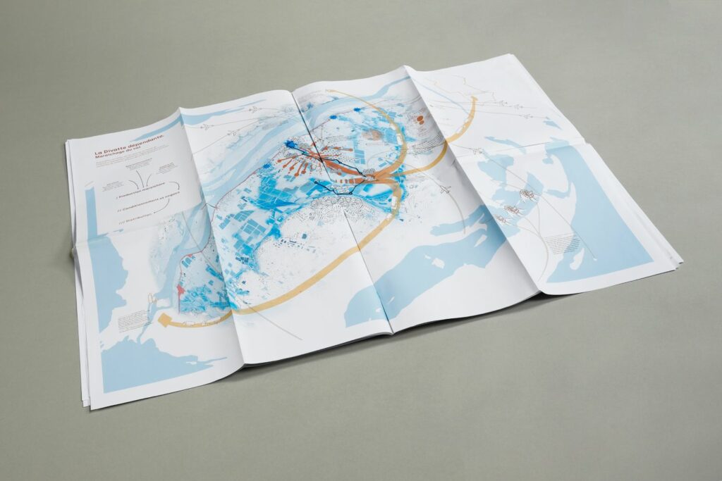
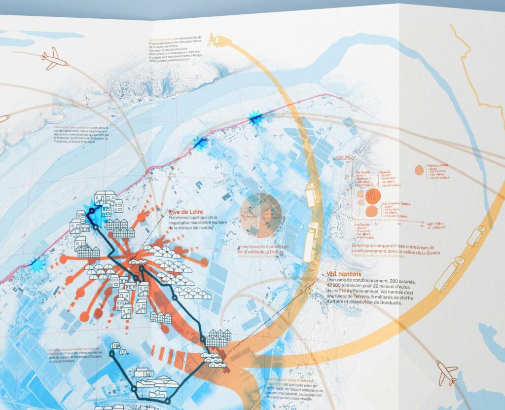
The second map focuses on the market garden industry in the valley, from its primary production areas to processing plants and exports. In the same way, the anamorphosis of the mapped territory makes it possible to play with scales to integrate migrant workers and their countries of origin, importing countries and areas of knowledge exchange around industrial market gardening.
Cartography is a powerful architectural tool. It allows us to understand, spatialise and synthesise several areas of research within a given territory. Far from being a simple representation tool, I use the map here as a constantly evolving research tool.